
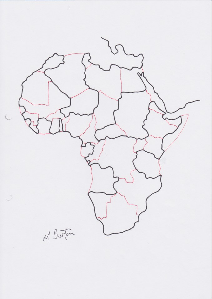
This map of Africal was in my school atlas of about 1958. The continuous line split the continent into two sequences of countries inside or outside the line. You can use two colours alternately inside the line and another pair of colours outside the line to only need four colours altold.
